


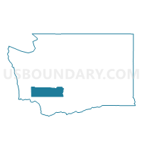
Randle East Voting District, Lewis County, Washington
About
Outline

Summary
| Unique Area Identifier | 687466 |
| Name | Randle East Voting District |
| County | Lewis County |
| State | Washington |
| Area (square miles) | 85.06 |
| Land Area (square miles) | 84.29 |
| Water Area (square miles) | 0.77 |
| % of Land Area | 99.09 |
| % of Water Area | 0.91 |
| Latitude of the Internal Point | 46.47075420 |
| Longtitude of the Internal Point | -121.84452570 |
Maps


Graphs
Select a template below for downloading or customizing gragh for Randle East Voting District, Lewis County, Washington


Neighbors
Neighoring Voting District (by Name) Neighboring Voting District on the Map
- Big Bottom Voting District, Lewis County, WA
- Randle West Voting District, Lewis County, WA
- Stabler Voting District, Skamania County, WA
- Wind Mountain North Voting District, Skamania County, WA